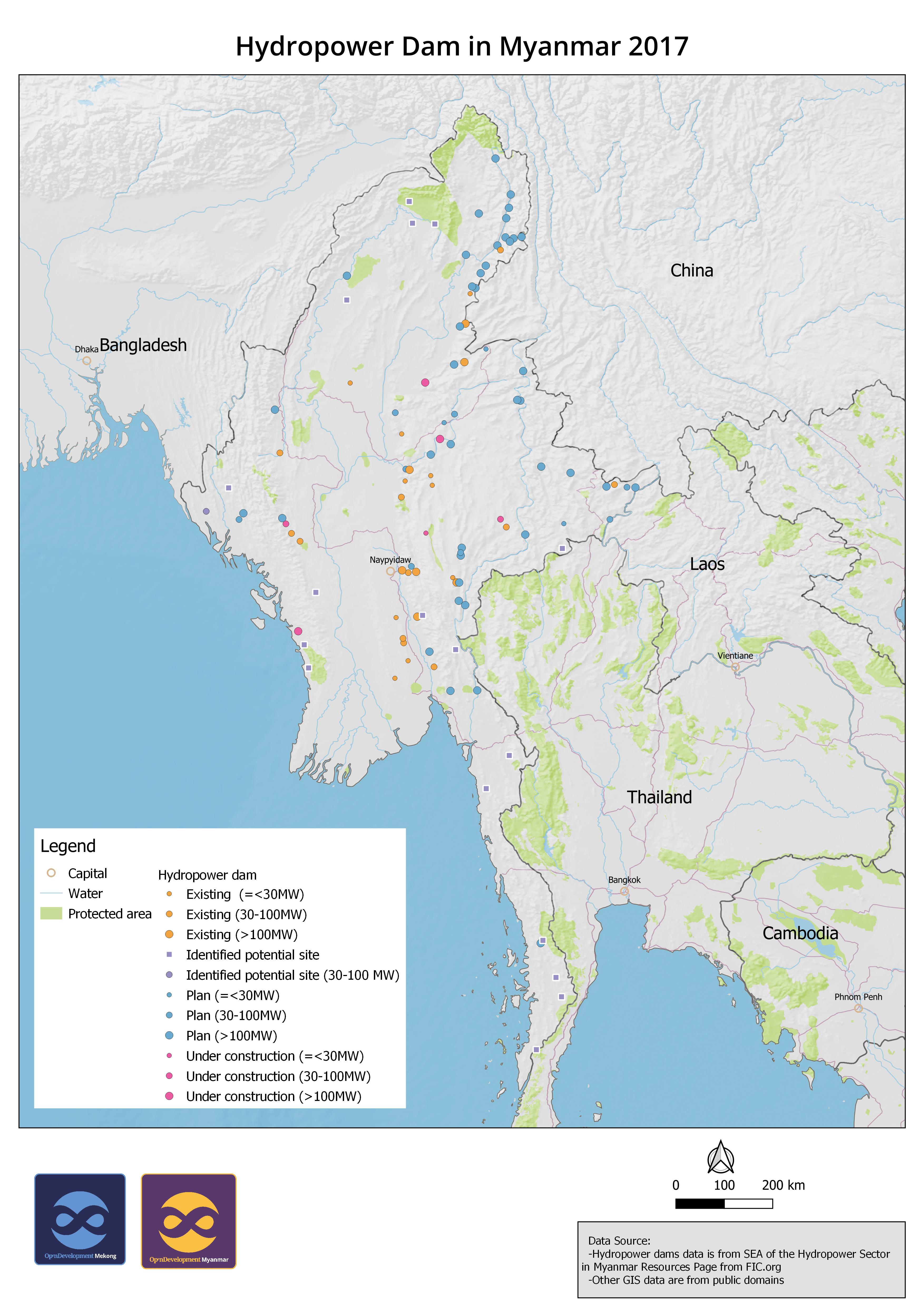
Hydropower Dams in Myanmar 2017
បោះពុម្ពផ្សាយដោយ៖ Open Development Myanmar
ធនធានទិន្នន័យ (7)
មើលធនធានទិន្នន័យ - [English] Hydropower Dam in Myanmar 2017
Additional Info
| Field | Value |
|---|---|
| ភាសា |
|
| កំហិតនៃការចូល និងប្រើប្រាស់ | There is no information about use limitation. |
| កាលបរិច្ឆេទយោងនៃសំណុំទិន្នន័យ | 1 មករា 2017 |
| ចន្លោះកាលបរិច្ឆេទបញ្ចប់ | 1 មករា 2017 |
| ឈ្មោះភូមិសាស្ត្រ |
|
| ព្រំកូអរដោនេខាងលិច | 92.6521835327148 |
| ព្រំកូអរដោនេខាងកើត | 100.720932006836 |
| ព្រំកូអរដោនេខាងត្បូង | 10.7752084732056 |
| ព្រំកូអរដោនេខាងជើង | 27.5259418487549 |
| ប្រព័ន្ធយោងក្នុងលំហ | WGS 84 (EPSG:4326) (CRS:84) |
| ភាពទៀងទាត់ | There is no information about positional accuracy. |
| ការចប់សព្វគ្រប់ | There is no information about completeness. |
| ជំហាននៃដំណើរ | The original data was downloaded and cleaned for producing geospatial data. The records with abbreviation were added with full words from publication. Then the data was converted to SQLite for uploading to GeoServer for visualization. |
| Lineage | International Finance Corporation (https://www.ifc.org/wps/wcm/connect/industry_ext_content/ifc_external_corporate_site/hydro+advisory/resources/sea+of+the+hydropower+sector+in+myanmar+resources+page) |
| អាជ្ញាប័ណ្ណ | Creative Commons Attribution Share-Alike |
| សិទ្ធិ | Yes |
| កំណែ | 1.0 |
| ពាក្យគន្លឹះ | hydropower myanmar |
| កាលបរិច្ឆេទផ្ទុកឡើង | តុលា 20, 2020, 00:38 (UTC) |
| កាលបរិច្ឆេទកែប្រែ | វិច្ឆិកា 11, 2020, 03:03 (UTC) |