Kampong Cham communal land use planning (CLUP) atlas 2009
Published by: Open Development Cambodia
Data Resources (7)
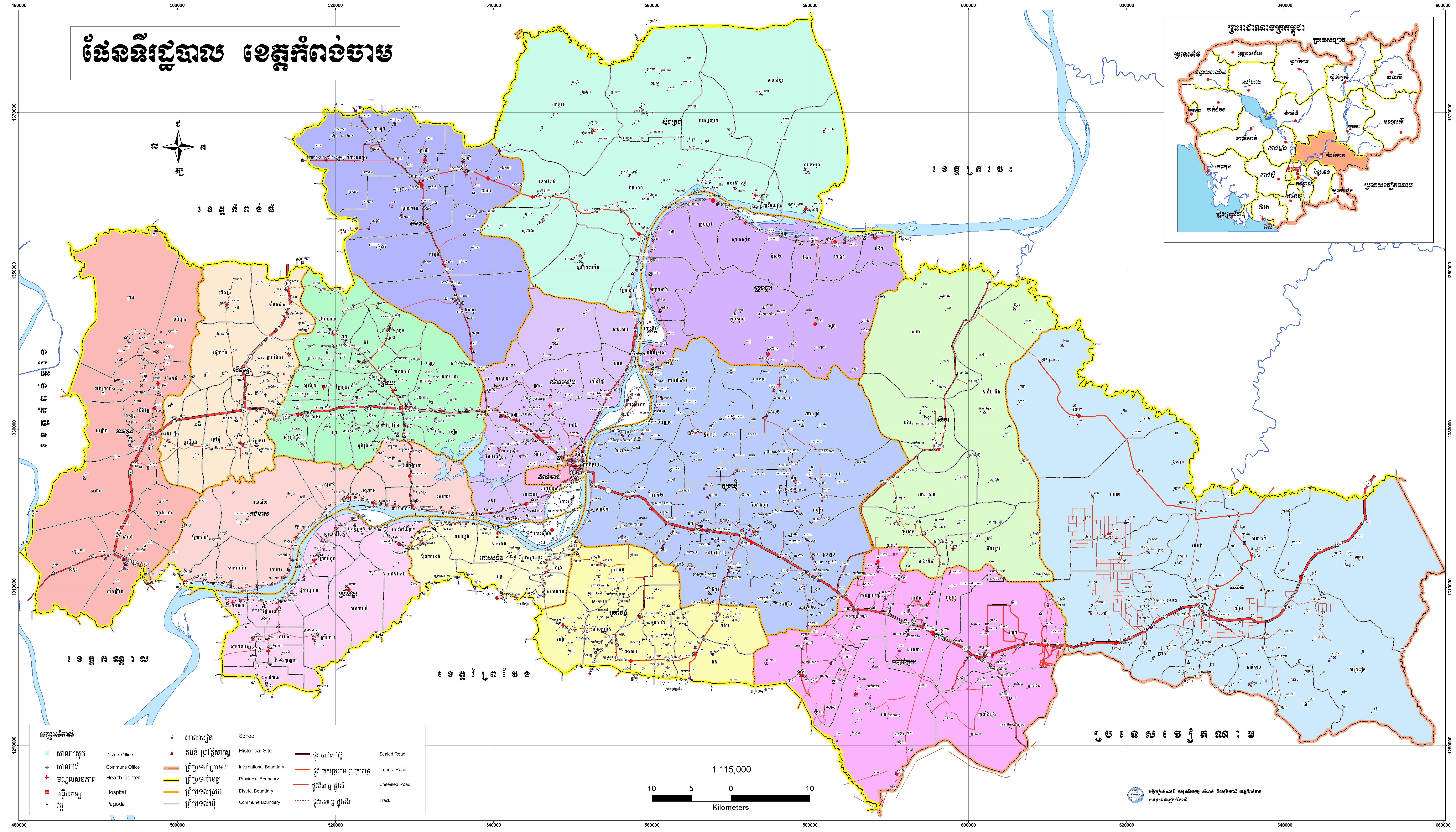
Data Resource Preview - Kampong Cham administrative map
Additional Info
| Field | Value |
|---|---|
| Dataset topic category |
|
| Language |
|
| Use limitations | By accessing this website or database, users agree to take full responsibility for reliance on any site information provided and to hold harmless and waive any and all liability against individuals or entities associated with its development, form and content for any loss, harm or damage suffered as a result of its use. |
| Dataset reference date | January 1, 2010 |
| GeoNames |
|
| Positional Accuracy | There are no known about the issues of accuracy. |
| Logical Consistency | There are no known issues with logical consistency. |
| Completeness | There are no known issues with completeness. |
| Process Step | ODC's map and data team collected CLUP ATLAS 2009 in DVD published in 2010 by Ministry of Land Management, Urban Planning and Construction (MLMUC). by keeping the original status and format, the team just only compressed the file by province and then uploaded them onto CKAN datahub for public uses. |
| Lineage | Ministry of Land Management, Urban Planning and Construction (MLMUC) Address: #771-773, Monivong Blvd, Sangkat Beng Trabek, Khan Chamkar Morn, Phnom Penh, Cambodia. |
| Responsible party | Ministry of Land Management, Urban Planning and Construction (MLMUC) Address: #771-773, Monivong Blvd, Sangkat Beng Trabek, Khan Chamkar Morn, Phnom Penh, Cambodia. |
| Metadata creator information | Metadata last updated on 2017-03-29. For inquiries contact: Open Development Cambodia (ODC). Address: #43 St. 208, Sangkat Boeung Raing, Khan Daun Penh, Phnom Penh, Cambodia. Email: contact@opendevcam.net Website: https://opendevelopmentcambodia.net |
| License | CC-BY-SA-4.0 |
| Copyright | Yes |
| Version | 1.0 |
| Province(s) |
|
| Date uploaded | April 18, 2017, 02:29 (UTC) |
| Date modified | June 12, 2018, 04:50 (UTC) |