-
Building footprints in Phnom Penh
 Cambodia
October 18, 2023
Source: Òpen Building:...
Cambodia
October 18, 2023
Source: Òpen Building:...
 Building footprints can be used for a variety of essential purposes, including population estimation, urban planning, and humanitarian response, as well as environmental and cli...
-
Mining concessions in Cambodia (1995-2022)
Cambodia
November 29, 2022
Source: The mining concession data available on ODC's website are from...
 This dataset contains data for mining concessions in Cambodia from 1995 to 2022. The data was collected from various sources such as government documents, news, company profiles...
-
Rainfall estimates from rain gauge and satellite observations (CHIRPS pentad dataset)
Cambodia
June 23, 2022
Source: The data is derived from...
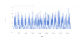 CHIRPS is an abbreviation for Climate Hazards Group InfraRed Precipitation with Station Data (Version 2.0 final). The CHIRPS is a 30+ year quasi-global rainfall dataset and inco...
-
Phnom Penh Water Supply Authority (PPWSA) master plan (2015-2021)
 Cambodia
August 10, 2020
Source: Phnom Penh Water Supply Authority (PPWSA),...
Cambodia
August 10, 2020
Source: Phnom Penh Water Supply Authority (PPWSA),...
 This data shows the Master Plan for the period 2015-2021 in order to allow a sustainable expansion of the Greater Phnom Penh Water Supply System (GPPWSS). The data shows the loc...
-
Sub-decree No. 184 on reclassifying 1,020 hectares of land from ELC in Kampong Chhnang province.
Cambodia
184 ANK.BK
Sub-decree
October 19, 2012
 Cutting 1,020 hectares of land in Krangleav commune of Rolea Bphea district in Kampong Chhnang province from economic land concession of Pheapimex, and reclassifying 935 ha as s...
-
Sub-decree No. 192 on Cutting and Reclassifying 2,567 hectares of Wildlife Sanctuary, Forest Concession and ELC in Battambang province
Cambodia
192 ANK.BK
Sub-decree
April 21, 2013
 Cutting a total land of 2,567 ha of land in Peam, Peamtar, O Ronong, O Kroch, O Treng, O Ta Teak, Ta Tauk, and Veal Rolem villages of Ta Tauk commune in Samloth district of Batt...