-
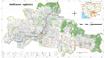
State land reclassification

 Cambodia
May 27, 2025
Source: Royal Gazettes of Cambodia
Cambodia
May 27, 2025
Source: Royal Gazettes of Cambodia
 This dataset contains information regarding the establishment of land as state public property and the reclassification to state private property of some areas in Phnom Penh, Ka...
-
Land cover in Cambodia (2015-2023)
Cambodia
December 21, 2024
Source: Servir SEA: https://cambodia-me-servir.adpc.net/mapviewer
 The Cambodia national Land Cover time series (2015-2023) was derived from the Biophysical M&E Dashboard tool, being used by USAID/Cambodia to track performance and report on lan...
-
Land Cover 2020 in Vietnam
 Viet Nam
June 16, 2023
Source: https://livingatlas.arcgis.com/landcover/
Vietnam 2020 Land Cover data is extracted from ESRI 2020 global vegetation cover data. The data is used machine learning to classify vegetation cover from Sentinel-2 data. Data ...
Viet Nam
June 16, 2023
Source: https://livingatlas.arcgis.com/landcover/
Vietnam 2020 Land Cover data is extracted from ESRI 2020 global vegetation cover data. The data is used machine learning to classify vegetation cover from Sentinel-2 data. Data ...
-
Land cover in Vietnam 2015 - 2018
Viet Nam
September 14, 2020
Source: https://www.eorc.jaxa.jp
Landcover dataset 2015 - 2018 in Vietnam is a data set processed from remote sensing images of JAXA space center Japan. The dataset used PALSAR-2 / ScanSAR and MODIS / NDVI mult...
-
CCI Land cover - 300 m annual global land cover time series from 1992 to 2015
Cambodia, Lao People's Democratic Republic, Myanmar, Thailand, Viet Nam
January 28, 2018
Source: Climate Change Initiative (CCI) of the European Space Agency...
In the framework of the Climate Change Initiative (CCI) of the European Space Agency, the CCI Land Cover partnership is pleased to announce the official release of the CCI 300 m...
-
Regional Land Cover
Cambodia, Viet Nam, Lao People's Democratic Republic, Thailand, Myanmar, China
October 27, 2016
Source: GlobCover 2009 (Global Land Cover Map) RELEASED ON 21st December...
The dataset contains a raster version of the GlobCover land cover map produced for the year 2009, clipped to the Greater Mekong Region. The land cover image is derived from the ...
-
Land cover of Vietnam 2009
Viet Nam
August 31, 2020
Source: Food and Agriculture Organization of the United Nations. FAO...
Dataset is polygon data with geospatial referecing. Land cover maps use as input observations from the 300m MERIS sensor on board the ENVISAT satellite mission. Maps cover perio...
-
Eviction and relocation hotspots in Cambodia (2013)
Cambodia
October 4, 2015
Source: Sahmakum Teang Tnaut and Save Cambodia's Wildlife. Atlas of...
 This asset provides the area of eviction hotspots and relocation hotspots in Cambodia, with raster value that demonstrates number of families affected, given by Sahmakum Teang T...
-
Systematic land registration in Cambodia (2013)
Cambodia
October 4, 15
Source: Ministry of Land Management, Urban Planning and Construction. Land...
 This dataset describes the status of systematic land registration in Cambodia's communes by March 2013, as given in the Cambodian Ministry of Land Management's Land Administrati...
-
Land Use. Forest Area. Cambodia, Laos, Myanmar, Thailand & Vietnam (2000-2015)
Cambodia, Lao People's Democratic Republic, Myanmar, Thailand, Viet Nam
June 30, 2018
Source: © FAO 2015 Land Use. Forest Area....
This dataset contains data from the FAOSTAT for the proportion of land use related to forests in Cambodia, Laos, Myanmar, Thailand & Vietnam. It covers the years from 2000 to 20...
-
Phnom Penh urban sprawl timeline (2003-2013)
Cambodia
December 6, 2015
Source: Landsat NASA 2003/13 http://landsat.gsfc.nasa.gov/
 Landsat satellite images are presented in this dataset of Phnom Penh detailing land use change in the year 2003 and 2013. Dataset were provided to Open Development Cambodia (ODC...
-
Pursat communal land use planning (CLUP) atlas 2009
Cambodia
April 18, 2017
Source: Ministry of Land Management, Urban Planning and Construction...
 Pursat communal land use planning(CLUP) atlas (Chamraeun Phal, Kbal Trach, Me Tuek, Phteah Rung, Prongil, Roleab, Ta Lou, Tnaot Chum commune) is communal land use planning extra...
-
Koh Kong communal land use planning (CLUP) atlas 2009
Cambodia
April 18, 2017
Source: Ministry of Land Management, Urban Planning and Construction...
 Koh Kong communal land use planning(CLUP) atlas (Andong Tuek, Chrouy Pras, Smach Mean Chey, Stung Veng, Tma Sa, and Trapeang Rung commune) is communal land use planning extracte...
-
Ratanakiri communal land use planning (CLUP) atlas 2009
Cambodia
April 18, 2017
Source: Ministry of Land Management, Urban Planning and Construction...
 Ratanakiri communal land use planning(CLUP) atlas (Aekakpheap, Ka Choun, Pong, Sameaki, Serei Mongkol, and Toen commune) is communal land use planning extracted from 2009 contai...
-
Siem Reap communal land use planning (CLUP) atlas 2009
Cambodia
April 18, 2017
Source: Ministry of Land Management, Urban Planning and Construction...
 Siem Reap communal land use planning(CLUP) atlas (Chan Sar, Doun Peaeng, Leang Dai, Nokor Pheas , Popel, Srae Khvav, Svay Chek, Tayaek commune) is communal land use planning ext...
-
Kampong Speu commune land use planning (CLUP) atlas 2009
Cambodia
March 29, 2017
Source: Ministry of Land Management, Urban Planning and Construction...
Kampong Speu commune land use planning(CLUP) atlas (Kiri Vaon, Moha Sang, Honorom, Prabei Mom, Prey Khmeng, and Yea Angk commune) is communal land use planning extracted from 20...
-
Kampong Cham communal land use planning (CLUP) atlas 2009
Cambodia
April 18, 2017
Source: Ministry of Land Management, Urban Planning and Construction...
 Kampong Cham communal land use planning(CLUP) atlas (Chikor, Moung Riev, Roang, and Srak commune) is communal land use planning extracted from 2009 contained both detailed curre...
-
Mondulkiri communal land use planning (CLUP) atlas 2009
Cambodia
April 18, 2017
Source: Ministry of Land Management, Urban Planning and Construction...
 Mondulkiri communal land use planning(CLUP) atlas (Dak Dam, Pu Chri, Saen Monourom, Srae Ampum, Srae Khtum, and Srae Preah commune) is communal land use planning extracted from ...
-
Preah Sihanouk communal land use planning (CLUP) atlas 2009
Cambodia
April 18, 2017
Source: Ministry of Land Management, Urban Planning and Construction...
Preah Sihanouk communal land use planning(CLUP) atlas (Angdoung Thma, Kampenh, Outreh, Samrong, and Tomnob Rolok commune) is communal land use planning extracted from 2009 conta...
-
Kep communal land use planning (CLUP) atlas 2009
Cambodia
April 18, 2017
Source: Ministry of Land Management, Urban Planning and Construction...
Kep communal land use planning(CLUP) atlas (Angkaol, Ou Krasar, and Pong Tuek commune) is communal land use planning extracted from 2009 contained both detailed current land us...