-
Population census 2019 (Provisional population totals)

 Cambodia
September 27, 2021
Source: Official website of National Institute of Statistics...
Cambodia
September 27, 2021
Source: Official website of National Institute of Statistics...
 This dataset provides a provisional census of the population in the Kingdom of Cambodia in 2019, which shows the total population, total population of males and females, total h...
-
Mine/ERW casualties (2005- 2013)
Cambodia
June 30, 2020
Source: Office for the Coordination of Humanitarian Affairs (OCHA) in Asia...
 This dataset shows information about locations of casualties caused by explosive remnants of war (ERW) and mines from 2005 to 2013 across Cambodia. Plus, it also includes number...
-
NGOs working on land tenure and titling issues in Cambodia
Cambodia
Reports, journal articles, and research papers (including theses and dissertations)
Open Development Cambodia
2015
A list of some NGOs working on land tenure and titling issues in Cambodia. Though Open Development Cambodia attempted to make this list as comprehensive as possible, the list do...
-
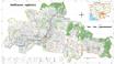
Pursat communal land use planning (CLUP) atlas 2009
Cambodia
April 18, 2017
Source: Ministry of Land Management, Urban Planning and Construction...
 Pursat communal land use planning(CLUP) atlas (Chamraeun Phal, Kbal Trach, Me Tuek, Phteah Rung, Prongil, Roleab, Ta Lou, Tnaot Chum commune) is communal land use planning extra...
-
Koh Kong communal land use planning (CLUP) atlas 2009
Cambodia
April 18, 2017
Source: Ministry of Land Management, Urban Planning and Construction...
 Koh Kong communal land use planning(CLUP) atlas (Andong Tuek, Chrouy Pras, Smach Mean Chey, Stung Veng, Tma Sa, and Trapeang Rung commune) is communal land use planning extracte...
-
Ratanakiri communal land use planning (CLUP) atlas 2009
Cambodia
April 18, 2017
Source: Ministry of Land Management, Urban Planning and Construction...
 Ratanakiri communal land use planning(CLUP) atlas (Aekakpheap, Ka Choun, Pong, Sameaki, Serei Mongkol, and Toen commune) is communal land use planning extracted from 2009 contai...
-
Siem Reap communal land use planning (CLUP) atlas 2009
Cambodia
April 18, 2017
Source: Ministry of Land Management, Urban Planning and Construction...
 Siem Reap communal land use planning(CLUP) atlas (Chan Sar, Doun Peaeng, Leang Dai, Nokor Pheas , Popel, Srae Khvav, Svay Chek, Tayaek commune) is communal land use planning ext...
-
Kampong Speu commune land use planning (CLUP) atlas 2009
Cambodia
March 29, 2017
Source: Ministry of Land Management, Urban Planning and Construction...
Kampong Speu commune land use planning(CLUP) atlas (Kiri Vaon, Moha Sang, Honorom, Prabei Mom, Prey Khmeng, and Yea Angk commune) is communal land use planning extracted from 20...
-
Kampong Cham communal land use planning (CLUP) atlas 2009
Cambodia
April 18, 2017
Source: Ministry of Land Management, Urban Planning and Construction...
 Kampong Cham communal land use planning(CLUP) atlas (Chikor, Moung Riev, Roang, and Srak commune) is communal land use planning extracted from 2009 contained both detailed curre...
-
Mondulkiri communal land use planning (CLUP) atlas 2009
Cambodia
April 18, 2017
Source: Ministry of Land Management, Urban Planning and Construction...
 Mondulkiri communal land use planning(CLUP) atlas (Dak Dam, Pu Chri, Saen Monourom, Srae Ampum, Srae Khtum, and Srae Preah commune) is communal land use planning extracted from ...
-
Preah Sihanouk communal land use planning (CLUP) atlas 2009
Cambodia
April 18, 2017
Source: Ministry of Land Management, Urban Planning and Construction...
Preah Sihanouk communal land use planning(CLUP) atlas (Angdoung Thma, Kampenh, Outreh, Samrong, and Tomnob Rolok commune) is communal land use planning extracted from 2009 conta...
-
Kratie communal land use planning (CLUP) atlas 2009
Cambodia
April 18, 2017
Source: Ministry of Land Management, Urban Planning and Construction...
 Kratie communal land use planning(CLUP) atlas (Dar, Kbal Damrey, O Krieng, Ruessei Kaev, Saob, Srae Char, Svay Chreah, and Thmi commune) is communal land use planning extracted ...
-
Conversion timber, forest monitoring, and land-use governance in Cambodia
Cambodia
Reports, journal articles, and research papers (including theses and dissertations)
Forest Trends Association
2015
This report presents an overview of national patterns and practices of forest land clearance during the 2012-2013 dry season as a basis for discussing challenges for Forest Law ...
-
[Draft] Environmental and Social Impact Assessment (ESIA) Stung Pursat 1 hydroelectric project (80MV) in Veal Veng district Pursat province (BOT)
Cambodia
KTC Cable was registered in Seoul, South Korea on August 2005 and focus on electric and optical wire production for all telecommunication network. In 2006 this company received ...
-
Agro-Ecological Regions of Myanmar
Myanmar
November 6, 2019
Source: Saxon, E.C., and Sheppard, S. M., 2013. Agro-ecological Zones of...
The zonation is based on three factors, each reflecting physical constraints on agriculture: altitude, slope, rainfall, and nutrient availability. The Ago-Ecological Zones are t...
-
[Draft] Environmental Impact Assessment: Cambodia Block A Development
Cambodia
Chevron Overseas Petroleum (Cambodia) plans to develop the Apsara field in the Block A concession, which is 4 709 square km in area and located approximately 157 km offshore fro...
-
Mine and Explosive Remnant of War (ERW) accident casualties (2016-2017)
Cambodia
June 30, 2020
Source: Monthly Report for December 2017 published by the Cambodian Mine...
 This dataset contains information, extracted from Monthly Report for December 2017 of Cambodia Mine/ERW Victim Information System (CMVIS) published by Cambodian Mine Action and...
-
Forest cover in Cambodia (1973-2014)
Cambodia
November 25, 2015
Source: U.S. Department of the Interior, United States Geological Survey...
 This dataset shows forest cover in Cambodia in 1973, 1989, 2000, 2004, 2009 and 2014. Geographic data is encoded in the WGS 84, Zone 48 North coordinate reference system. Data w...
-
Mine and Explosive Remnant of War (ERW) accident casualties (2018-2019)
Cambodia
June 23, 2020
Source: Monthly Report for March 2017 published by the Cambodian Mine...
 This dataset contains information, extracted from Monthly Report for October 2019 of Cambodia Mine/ERW Victim Information System (CMVIS) published by Cambodian Mine Action and ...
-
Environmental and social impact assessment: Kamchay hydroelectric project in Kampot province
Cambodia
The Shinohydro is one of the leading company to utilize the water for producing electricity that has 10 subsidiaries and 70 network companies. The company invests in constructio...